
By Sanjana H
Colombo, December 5 – A journalist asked me today if the Sri Lankan Meteorological Department, and Disaster Management Centre’s respective Facebook, and web output had improved from the shambolic state it was during the height of Cyclonic Storm Ditwah, severely, and asymmetrically impacting Tamil-speaking peoples in the country.
The short answer is no.
I Studied 34 posts to Facebook on the DMC’s official page from 29 November to 5 December, generating 1,104 reactions, and 769 shares. Despite calling for volunteers to boost their trilingual disaster communications capacity, a study of the Facebook posts indicates Tamil-speaking communities in affected areas, if reliant on this vector for their information, and updates, continue to face significant information gaps regarding evacuation zones, international assistance arriving, and vulnerable population services.
For starters, the banner image with its critical information, continues to be in Sinhala only.
Landslide Early warnings
The 4 December 1600 hours landslide early warning issued by the National Building Research Organisation (NBRO) appears in both Sinhala and English but has no Tamil version.
This Level 3 evacuation warning covers extensive areas across Kandy district (including Ganga Ihala Korale, Thumpane, Medadumbara, Akurana, Kundasale and fifteen other divisions), Kegalle district (eight divisions), Kurunegala district (six divisions) and Matale district (nine divisions). The extremely detailed 29 November landslide warning exists only in Sinhala.
This comprehensive alert lists affected areas across thirteen districts under three warning levels. Level 3 red alerts requiring immediate evacuation cover Badulla (thirteen divisions), Colombo (two divisions), Gampaha (one division), Kalutara (three divisions), Kandy (twenty-two divisions), Kegalle (eleven divisions), Kurunegala (six divisions), Matale (nine divisions), Moneragala (two divisions), Nuwara Eliya (ten divisions) and Ratnapura (fifteen divisions).
Level 2 amber alerts cover parts of Galle, Kalutara, Moneragala and Ratnapura. Level 1 yellow alerts extend to Colombo, Gampaha, Hambantota and Matara districts with numerous subdivisions specified.
Kelani River basin and Kalu River warnings: A warning specific to the Ambatale flood control weir appears only in Sinhala, alerting residents living in low-lying areas between the Ambatale weir and the Kaduwela main road to evacuate to safe locations due to rising water levels in the Kelani River.
A separate brief Sinhala-only post confirms the Ambatale weir has begun overflowing. The Kalu River basin flood warning similarly appears only in Sinhala with no English or Tamil version.
Emergency helpline information for vulnerable populations: A Sinhala-only post announces two toll-free 24-hour trilingual helplines operated by the Ministry of Women and Child Affairs. The National Women’s Committee operates 1938 for information about disaster-affected women, whilst the National Child Protection Authority operates 1929 for information about disaster-affected children. This welfare-focused information would not have been understood by Tamil-speaking communities.
Met Department’s Updates
Studied 143 updates to Facebook by the Met Department from 29 November to 5 December, generating 209 comments, 5,573 reactions,and 2,473 shares.
Tamil-speaking communities reliant on this vector of official news, and information receive core forecast information, and cyclone tracking updates but miss extended planning forecasts, lightning safety alerts, and importantly, official communications addressing very harmful, and panic-inducing misinformation.
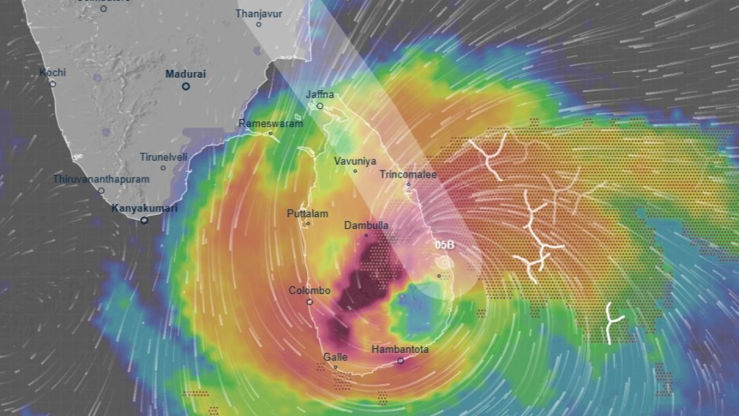
Detailed explanatory communication about Cyclone Ditwah and misinformation (30 November): This day say a substantive Sinhala-only post providing comprehensive public communication about Ditwah’s progress, and movement away from Sri Lanka. This post includes satellite imagery from China’s FY-4B satellite showing Sri Lanka and the Bay of Bengal, explains that Cyclone Ditwah has weakened to a deep depression centred approximately 240 km northeast of Kankasanthurai, and confirms the system no longer directly affects Sri Lanka’s land weather. The post explicitly states that rainfall from this system will no longer occur over Sri Lanka, though strong wind warnings remain valid for sea areas from Trincomalee to Mannar via Kankasanthurai.
This post directly addresses false rumours circulating on social media claiming another cyclone will affect Sri Lanka in the coming days of December. The Met Dept explains that cyclones do not form suddenly but must progress through several stages including low pressure, depression, and deep depression before becoming a cyclone, a process requiring several days.
The communication states that no atmospheric disturbance has been identified in analysis that could develop near Sri Lanka during the coming week, and reassures the public that such conditions can typically be detected approximately five days in advance, allowing timely warnings.
This misinformation-debunking content, which carries significant public safety implications, was not communicated in Tamil (or English for that matter).
36-hour general weather forecasts
The extended 36-hour weather forecasts issued at 4:00 p.m. daily appear consistently in Sinhala and English but have no Tamil equivalents, at all.
The 29, 30 November and 1, 2, 3, 4 December 36-hour forecasts provide more comprehensive planning information than single-day forecasts, including overnight conditions followed by next-day predictions. These forecasts during the height of Ditwah’s fury contained particularly detailed information about expected heavy rainfall thresholds (above 100mm in some areas, above 50mm in others), specific wind speed predictions (50-60 kmph gusting to 70-80 kmph), and geographic breakdowns of affected provinces and districts.
Severe lightning advisory (4 December)
The advisory for severe lightning issued at 3:30 p.m. on 4 December, valid until 11:30 p.m. the same day, appears only in Sinhala and English. Tamil-speaking peoples are left to look up at the sky, and somehow understand the heightened risk of lightning.
Bizarre discrepancy in morning, and afternoon forecasts: For indeterminable reasons, the afternoon forecasts by the Met Dept issued at 2pm consistently lack Tamil versions, while the morning forecasts issued at 5.30am typically have Tamil equivalents. The 2pm sea area forecasts for 2, 3 and 4 December all appear in Sinhala and English only.
These forecasts contain critical information for fishing communities, including rainfall predictions for specific coastal stretches, wind directions and speeds for different sea areas, sea state conditions, and warnings about temporarily strong gusty winds and very rough seas during thundershowers.
The afternoon forecasts represent updated assessments based on how the day’s weather has developed, potentially containing significant changes from morning predictions that fishing vessels already at sea would need to know.
Similarly, the 2pm land forecasts issued on 2, 3 and 4 December for the following day appear only in Sinhala and English. These afternoon updates for the next day’s weather would reflect any shifts in meteorological conditions observed during the day. For whatever reason, this systematic gap in afternoon forecast translation means Tamil-speaking coastal communities, particularly in the Northern and Eastern provinces where significant Tamil-speaking fishing populations reside, receive weather information that may be twelve hours out of date compared to Sinhala and English speakers.
During a post-cyclone period when conditions remained unstable, this timing gap carries meaningful safety implications.
Met Dept landslide warnings or early warnings
Studied 8 landslide early warnings or warnings published on the Met Dept’s website from 29 November to 4 December.
There are clear information vacuums, and asymmetries for Tamil-speaking peoples reliant on this vector for official updates, information, and timely alerting of landslide threats, and risks. While the technical core of the warnings aims for trilingual reach, critical administrative directives and geographic specifics remain heavily weighted towards Sinhala and English, potentially disenfranchising Tamil-speaking stakeholders, and placing them at heightened risk.
Take for example the administrative cover letters issued by the Disaster Management Centre (DMC), which appear as the initial pages of the documents bearing Message IDs LEWM-04-12-2025-1930-25 and LEWM-04-12-2025-1600-24. The operative content of the correspondence is composed entirely in Sinhala.
Paragraphs 2 and 3 of these respectively letters contain vital command-and-control instructions. The second paragraph explicitly requests District Secretaries and military officials to “minimise potential disaster situations,” “control” the events, and engage in “management” based on the attached technical report. The third point or paragraph directs officials to act vigilantly regarding future updates and provides the hotline number 117 for further technical advice.
A Tamil-speaking official or citizen reviewing this cover sheet receives none of these specific operational orders, as the Tamil text is entirely absent from the body of the letter. Sinhala audiences, and readers receive a clear call to action, and a protocol for disaster mitigation.
There’s also issues with legends, and explanatory notes highlighted by green bands across all the updates, including LEWM-03-12-2025-1600-23, LEWM-01-12-2025-1600-21, and LEWM-30-11-2025-1600-20. The English text within these bands provides a crucial legend for interpreting the dynamic nature of the threat: it defines an upward arrow (↑) as a warning level shifted up, a downward arrow (↓) as a level shifted down, and double arrows as two-level shifts. This information allows an English reader to assess whether the danger is escalating or subsiding.
A Tamil reader observing an arrow next to a town name, like “↓ Passara” in LEWM-29-11-2025-1600-19, has no idea what this actually means, because the explanatory key to understand that this symbol represents a de-escalation of the threat level is not published in Tamil.
Place names in the Met Dept alerts are nearly exclusively in English, using Roman characters. The geographic identification of at-risk communities relies almost exclusively on English, creating a barrier to location-specific awareness for those literate only in Tamil.
In every alert/warning, the specific Divisional Secretariat Divisions (DSDs) like “Uva Paranagama,” “Soranathota,” “Ambagamuwa,” and “Padukka” are listed using the Roman alphabet. While the column headers “District” and “Level” include Tamil translations, the data within the rows does not.
A Tamil-speaker residing in the Nuwara Eliya district, for instance, might understand from the colour code that a “Level 2 (Amber)” warning exists, but they would be unable to decipher which specific towns are affected without the ability to read the English place names. This presumption of English proficiency for geographic data denies the Tamil reader the granular precision necessary for time-sensitive personal safety planning for themselves, family, loved ones, neighbours, relatives, friends etc.
Weather forecasts, and reporting by Met Dept
Total erasure of technical forecasts for multi-day fishing boats: In the update published on 30 November, titled “Weather forecast for multi-day boats”, the English and Sinhala sections provide a highly detailed technical breakdown of weather conditions across specific latitude and longitude blocks (e.g., “09N-18N, 80E-85E” and “EQ-09N, 80E-90E”).
For these specific zones, the English and Sinhala texts specify wind directions (e.g., “Anticlockwise”), wind speeds (e.g., “60-70 kmph”), and precise sea states (e.g., “Very rough to high” or “Slight to Moderate”). This entire section, which is vital for deep-sea mariners navigating the Bay of Bengal, Arabian Sea, and South Indian Ocean, is completely absent in the Tamil sections of the provided documents. Tamil-speaking fishermen are thus denied the navigational weather data necessary for safe passage in these specific deep-sea zones.
Total erasure of information in Tamil:
The total absence of Bulletin No. 33 on 1 December in Tamil is, for Tamil speaking peoples who rely on this website for critical updates especially in the aftermath of a major natural disaster, a significant safety and economic hazard. This is particularly so Tamil speaking peoples, and fisherfolk in littoral areas in the Northern Province, as the alert explicitly centres on the sea area “North of Kankasanthurai”. Kankasanthurai (KKS) is a major, and very busy harbour town in the Jaffna District. The Met Dept effectively denies the local Tamil population access to the most current data regarding the storm’s position relative to their own coastline. Tamil-speaking residents and sea-going folk are left relying on obsolete morning data, unaware that the system has moved further north and away from their immediate vicinity. The English, and Sinhala bulletins provide a precise validity period extending to 4am on 2 December, along with a revised trajectory that confirms the storm’s path is parallel to but distancing itself from the Sri Lankan coast. A Tamil-speaking boat captain, lacking this specific afternoon update, would not have the confirmation that the system is tracking towards Latitude 13.0°N. This lack of situational awareness could have led to poor navigational decisions.
Weather reports on 29 November
Given the cyclonic activity, the Met Dept issued 10 weather reports on 29 November. The Sinhala and English updates/content consistently offer greater granularity regarding impact assessments, specific damage warnings, and technical definitions than the Tamil counterparts.
The English and Sinhala headers provide a precise legend defining rainfall intensity categories: “Light: 00-12.5mm,” “Moderate: 25-50mm,” “Fairly heavy rain: 50-100mm,” and “Very heavy rain: 150mm or more.” This quantitative key is essential for interpreting the severity of the forecast.
The corresponding Tamil sections omit this legend entirely, proceeding directly to the forecast text. Consequently, Tamil readers encounter terms like “heavy rain” without the accompanying scientific definition of the millimetre ranges that constitute such a classification.
Granularity of Damage, and Impact
The “Damage Expected” sections, particularly within the Red alerts display a significant loss of detail in Tamil. The English and Sinhala texts provide a specific inventory of potential hazards, explicitly listing “damage to harbor yachts,” “flash floods,” and specific agricultural risks such as damage to “banana, papaya trees and orchards.”
In contrast, the Tamil updates tend to generalise these risks. For instance, where the English specifically warns of damage to “harbour yachts,” the Tamil text often omits this specific reference, potentially leaving Tamil fisherfolk docked in harbours less informed of the specific risk to stationary vessels compared to the general warning given to those at sea.
Similarly, the specific listing of “banana and papaya” crops in English serves as a direct alert to farmers cultivating those specific fruits, whereas the Tamil text often uses broader terms for agricultural damage.
Roman Alphabet Use
In the heavy rain warnings that include tables of observed rainfall (such as the table listing “Puliyam Pokkanai” with 274.0mm), the station names are presented exclusively in English, using the Roman alphabet, and Sinhala script (like example in previous section).
While the column headers are translated into Tamil, the actual locations, which are critical data points for understanding exactly where the heaviest rain has fallen, are neither translated nor transliterated into Tamil.
A Tamil reader who didn’t read English or Sinhala would be able to read the rainfall amount but would be unable to identify the specific town or station associated with that figure, effectively rendering the geographic distribution of the risk unintelligible.
Instructions Absent in Tamil
The English and Sinhala versions of the “Action Suggested” sections often contain more explicit command-and-control directives, unlike the text in Tamil. For example, in the Red alerts, the English text explicitly advises the public to “contact the local disaster management authorities” for emergency assistance and lists specific precautionary actions regarding “wired telephones and connected electric appliances.”
While the Tamil versions include the general warning to be vigilant, the specific instruction regarding the hierarchy of response, specifically directing citizens to local disaster management authorities, is often less emphasised or phrased more broadly or passively, potentially resulting in a lack of clarity regarding the immediate chain of command for assistance.
A week after Cyclone Ditwah devastated Sri Lanka, claiming over 80 lives and displacing hundreds of thousands, the official disaster communications from both the DMC, and the Met Dept continue to exhibit systematic discrimination against Tamil-speaking communities.
Dependence on South Indian Sources for Info
It goes without saying that the information ecology surrounding Ditwah, and its aftermath has rapidly evolved since the cyclone’s peak fury: vernacular mainstream media coverage, WhatsApp group chats, domestic citizen journalism networks, web-based news portals, and crucially, South Indian news channels publishing, and posting content in Tamil to social media would have filled critical information gaps, providing affected populations with weather updates, damage assessments, and relief coordination that official Sri Lankan channels failed to deliver in their mother tongue.
Yet this adaptive resilience of Tamil-speaking communities, forced to seek life-saving information from foreign sources on social media, niche websites, and informal networks on IM apps does not absolve the state of fundamental obligations especially during a historically unprecedented natural disaster. The continued absence of Tamil in landslide evacuation orders, the persistent twelve-hour delay in afternoon forecast translations, the Sinhala-only misinformation-debunking communications, the English-only administrative directives to district officials, and the total erasure of Tamil from multi-day fishing vessel forecasts reveal something more troubling than mere capacity constraints.
These patterns, studied across 34 DMC posts, 143 Met Department updates on Facebook, and multiple website publications over the week following Ditwah’s landfall, demonstrate that Sri Lanka’s official disaster communication architecture remains structurally incapable of, or institutionally unwilling to, treat Tamil-speaking citizens as deserving equal access to life saving information. It’s really as simple as that. As I keep stressing, and warning, the digitalisation of disaster response, rather than democratising access to timely information, risks amplifying this discrimination with lethal efficiency.
END